Orienteering
Hartwood Acres Park is home to two new orienteering courses, that provide the opportunity to learn basic land navigation by finding checkpoints throughout a set course.
Please download the instructions and the map(s) before attempting an orienteering course.
Learn more about orienteering or join the Western PA Orienteering Club for more local adventures.
Basics & Terminology
Orienteering
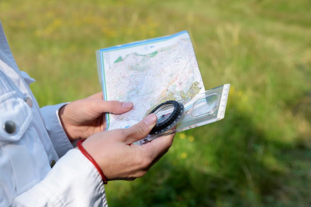
Orienteering is a sport and recreational activity where participants use a detailed topographic map and a compass to find marked locations in the woods, called controls. There are variations of orienteering, and the form of orienteering used at Hartwood Acres Park is known as “score”. Though no scoring will actually be done, this version of the sport allows participants to go to any number of controls in any order.
Orienteering does not specify coordinates of control locations or the distances to them, or use the names of any trails or other features that may appear on a typical park map. Note: maps are metric and drawn to International Orienteering Federation standards, with exceptions noted.
Controls are marked with posts topped with red and white signs in the woods and denoted with circles on the maps.
Each course map has markings specific to the course, though both courses in Hartwood Acres Park have the same beginning and end symbols:
 Purple triangle marks the start
 Purple double circle marks the end
| Orienteering Terminology |
| Cairn |
A pile of rocks, often intentionally arranged to indicate a trail or direction |
| Copse |
A small group of trees |
| Contours |
Connections between points of equal elevation |
| Form Line |
Indicates the shape of the land between two contours |
| Knoll |
A small hill or mound |
| Reentrant |
A place where the contour lines bend to indicate a ravine or place where a stream could start |
| Ride |
Resembles a trail or path that is not intended for human traffic, often a buried water line or gas line or old logging road |
Beginner
The beginner orienteering track is an easy course that can be completed by going about 2.3 km (~1.4 mi) within Hartwood Acres Park. There are a total of nine controls on the beginner course.
The following descriptions indicate exactly what mapped feature each control is at, without revealing its physical location.
| Beginner Course - 9 Controls |
Start Marker
|
South end of path |
| Control Marker 1 |
Northwest side of path crossing |
| Control Marker 2 |
Lone tree |
| Control Marker 3 |
Bend in path |
| Control Marker 4 |
Southwest side of utility pole |
| Control Marker 5 |
Southeast side of path crossing |
| Control Marker 6 |
West end of seasonal stream |
| Control Marker 7 |
East path junction |
| Control Marker 8 |
West edge of clearing |
| Control Marker 9 |
North side of path and stream crossing |
Intermediate
The intermediate orienteering track is a more challenging course that can be completed by going about 4.5 km (~2.8 mi) within Hartwood Acres Park. There are a total of 13 controls on the intermediate course.
The following descriptions indicate exactly what mapped feature each control is at, without revealing its physical location.
| Intermediate Course - 13 Controls |
Start Marker
|
South end of path |
| Control Marker A |
West side of NE spring |
| Control Marker B |
South edge of clearing |
| Control Marker C |
West side of ruin |
| Control Marker D |
West side of pit |
| Control Marker E |
Top of hill |
| Control Marker F |
East side of middle boulder, 1.3m high (~4.25 ft) |
| Control Marker G |
East side of boulder, 0.4m high (~1.3 ft) |
| Control Marker H |
Upper part of reentrant |
| Control Marker J |
Lower part of reentrant |
| Control Marker K |
Southeast outside corner of open land |
| Control Marker L |
Southwest end of cliff, 1.3m high (~4.25 ft) |
| Control Marker M |
West side of spring |
| Control Marker N |
Top of hill |